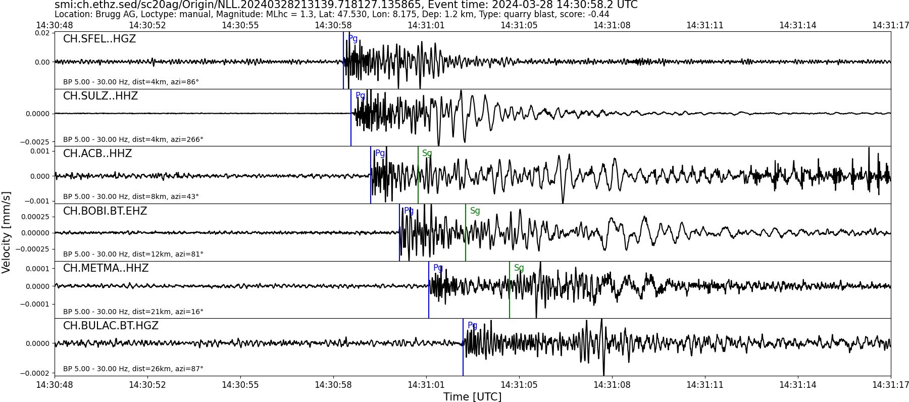
| Local time | 2024-03-28 15:30:58 |
|---|---|
| UTC Time | 2024-03-28 14:30:58 |
| Event Type | quarry blast |
| Latitude / Longitude | 47.53 / 8.18 |
| Swiss Coordinates | 655486 / 264652 |
| Magnitude | 1.3 |
| Magnitude Type | MLhc |
| Location | Brugg AG |
| Depth [km] | - |
| Location Type | manual |
| Agency | SED |
| Last Update | 28-03-2024 21:31:42 |
| Danger level | 1 (as defined by federal agencies with responsibility for natural hazards) |
| Origin ID & Metadata | smi:ch.ethz.sed/sc20ag/Origin/NLL.20240328213139.718127.135865 |
|
GSE 2.1 provisional format |
|---|
| BEGIN GSE2.1 MSG_TYPE DATA MSG_ID 2024/03/28_023548200 CHE_NDC DATA_TYPE BULLETIN GSE2.1:short Reviewed Event Bulletin (REB) of the CHE_NDC for March 28, 2024, 02:30:58.212 EVENT 2024/03/28_023058212 LAUFENBURG Date Time Err RMS Latitude Longitude Smaj Smin Az Depth Err Ndef Nsta Gap mdist Mdist Qual Author OrigID 2024/03/28 14:30:58.21 0.06 47.5479 8.1635 5093.0 2753.8 131 1.7 1.5 9 9 141 0.04 1.51 a i uk SED -------- Magnitude Err Nsta Author OrigID MLhc 1.9 0.3 5 SED -------- Sta Dist EvAz Phase Time TRes Azim AzRes Slow SRes Def SNR Amp Per Qual Magnitude ArrID SULZ 0.04 239.9 P 14:30:59.300 0.0 ___ 4729.0 a__ MLhc 1.9 -------- ACB 0.07 57.3 P 14:30:59.985 0.0 ___ 1379.0 a__ MLhc 1.5 -------- BOBI 0.12 90.8 P 14:31:00.950 0.0 ___ 719.9 a__ MLhc 2.2 -------- METMA 0.18 20.6 P 14:31:01.970 0.0 ___ 252.1 a__ MLhc 1.9 -------- BULAC 0.24 91.3 P 14:31:03.220 -0.1 ___ a__ -------- PANIX 0.97 138.4 P 14:31:17.800 0.4 ___ a__ -------- GSF03 0.98 171.4 P 14:31:17.750 0.1 ___ 102.3 a__ MLhc 2.2 -------- NALPS 1.03 157.7 P 14:31:19.920 1.3 ___ a__ -------- VD3T2 1.51 230.4 P 14:31:17.585 -7.6 ___ a__ -------- STOP |